United States and India Successfully Deploy NISAR Satellite for Earth's Surface Variation Observation
NASA-ISRO Synthetic Aperture Radar (NISAR) Satellite Launched, Set to Revolutionize Earth Observation
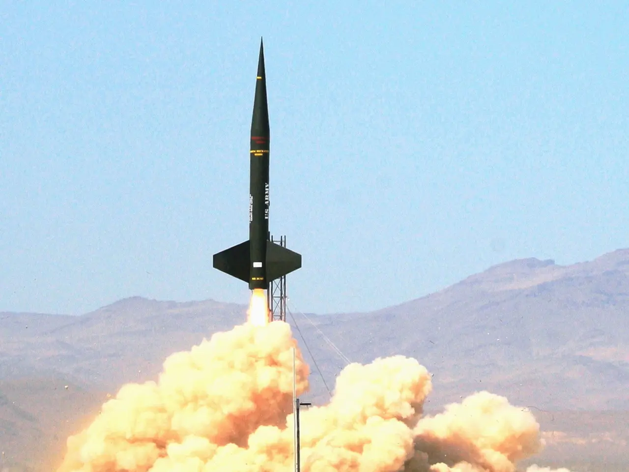
The NASA-ISRO Synthetic Aperture Radar (NISAR) satellite, a groundbreaking Earth-observing mission, was successfully launched on July 30, 2025, from Sriharikota, India, aboard India's GSLV-F16 rocket. This marks a major milestone in international collaboration between NASA and ISRO, with a mission cost of about $1.5 billion.
NISAR is a first-of-its-kind dual-frequency radar imaging satellite, carrying two advanced synthetic aperture radars: one L-band radar supplied by NASA and one S-band radar built by ISRO. This innovative combination allows NISAR to scan almost all of Earth's land and ice surfaces every 12 days, providing detailed, high-precision measurements of the planet's changing surface.
The satellite orbits at about 743 km in a sun-synchronous path, with a 98.4° inclination. Technically, NISAR uses synthetic aperture radar technology to produce fine-resolution images regardless of clouds or darkness, overcoming limitations of optical sensors. The combination of dual frequencies allows scientists to analyze different surface characteristics and active processes with unprecedented resolution and repeat coverage every 12 days.
NISAR's mission includes tracking glacial melting, polar ice-sheet dynamics, forest biomass, wetlands, groundwater level changes, tectonic shifts, land subsidence, earthquakes, tsunamis, and landslides. The data collected by NISAR will be publicly available within days, democratizing climate and environmental data. Critical alerts provided by NISAR during emergencies will be in near-real time.
Scientific operations for NISAR are scheduled to begin by October 2025, following 90 days of system checkouts and antenna deployments, including a 12-meter gold-plated reflector. The satellite weighs approximately 2,392 kg and can detect ground movements as small as 1 cm, irrespective of weather or daylight.
The India-U.S. mission with NISAR is poised to transform scientific understanding of natural hazards, climate shifts, and surface dynamics worldwide. With a lifespan of approximately three to five years, NISAR's significance lies in its innovative dual-frequency radar system that offers highly detailed, frequent, and globally comprehensive Earth surface observations, enabling new scientific insights and practical benefits worldwide in understanding and managing Earth's dynamic systems, climate change, and natural hazards.
[1] NASA. (2022). NISAR: NASA-ISRO Synthetic Aperture Radar. Retrieved from https://nisar.jpl.nasa.gov/ [2] ISRO. (2022). NISAR: NASA-ISRO Synthetic Aperture Radar. Retrieved from https://www.isro.gov.in/nisar [3] NASA. (2025). NISAR Launch Successfully Completes a Decade-Long Effort to Create a Game-Changing Earth Observation Platform. Retrieved from https://www.nasa.gov/press-release/nisar-launch-successfully-completes-a-decade-long-effort-to-create-a-game-changing-earth-observation-platform [4] The Hindu. (2025). NASA-ISRO Synthetic Aperture Radar (NISAR) Satellite Launched Successfully from Sriharikota. Retrieved from https://www.thehindu.com/sci-tech/science/nasa-isro-synthetic-aperture-radar-nisar-satellite-launched-successfully-from-sriharikota/article39094213.ece
- The remarkable launch of the NASA-ISRO Synthetic Aperture Radar (NISAR) satellite, a collaborative project between NASA and ISRO, represents a significant stride in environmental-science and technology, costing approximately $1.5 billion.
- The successful deployment of NISAR, aboard India's GSLV-F16 rocket from Sriharikota, India, will revolutionize Earth observation, providing 12-day coverage of almost all Earth and ice surfaces.
- In addition to its innovative dual-frequency radar system, NISAR's cutting-edge synthetic aperture radar technology allows for high-precision measurements despite weather, clouds, or daylight conditions.
- The NISAR mission encompasses a wide range of objectives, from monitoring climate-change effects like glacial melting and polar ice-sheet dynamics to detecting natural hazards such as earthquakes, tsunamis, and landslides.
- With a lifespan of around three to five years, NISAR has the potential to significantly advance our understanding of Earth's surface dynamics and natural hazards, offering practical benefits across various industries, including finance, energy, and space-and-astronomy.
- The successful launch and operation of NISAR mark a significant step towards a more comprehensive and scientifically informed approach to managing Earth's ever-changing environment.


